Research & Development

Projet

SEMMACAPE

Monitoring and study of marine megafauna in wind farms by automatic characterisation

Motivation & background

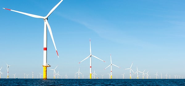
The development of offshore renewable energy is booming in France. Between 2011 and 2017, the French government has launched 5 calls for tenders and expressions of interest for a total of 7 wind farms installed, 4 wind pilot farms and 2 tidal pilot farms. Over the next 5 years, 5 additional calls for tenders are scheduled, which could double the installed capacity at sea. According to the Environmental Code, project developers must produce environmental impact studies, particularly on marine megafauna (birds, mammals, turtles, big fish…).

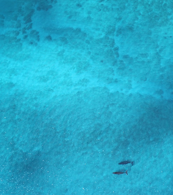
The analysis of the impacts of an ORE project generally requires aerial observations of marine megafauna in order to better characterise the frequentation of species in the proposed areas. This includes monitoring during the construction, operation and decommissioning phases, a total of about 30 years.

These observations are classically based on aerial overflights by specialised naturalist observers. However, in the age of big data, recent scientific and technological developments offer new prospects for radically improving the cost-effectiveness of such monitoring

L’analyse des impacts d’un projet EMR nécessite généralement des observations aériennes de la mégafaune marine afin de mieux caractériser la fréquentation des espèces dans les zones proposées. Cela inclut un suivi pendant les phases de construction, d’exploitation et de démantèlement, soit au total environ 30 ans.

Ces observations sont classiquement basées sur des survols aériens embarquant des observateurs naturalistes spécialisés. Cependant, à l’ère du big data, les récents développements scientifiques et technologiques offrent des perspectives nouvelles pour améliorer radicalement le rapport coût/efficacité de ces suivis.

SEMMACAPE Project

Objective

  • To demonstrate the ability of aerial photography processing and analysis software to automatically inventory marine megafauna.

Scientific content

Aerial megafauna observation campaign (standard visual method and VHR digital photography system), integrating the seasonal variability of species and environmental conditions.

Development and qualification of 2 types of automatic aerial photography processing algorithms for animal identification and classification:

• Detection by deep neural (end-to-end) network, moving directly from the global image to bounding boxes
• Detection of anomalies by unsupervised deep learning

Assessment of the performance of each detection method tested based on indicators classed by species or group of species, as well as according to environmental conditions.

Conclusion

Lorem ipsum dolor sit amet consectetur.

Sagittis maecenas aliquam integer lobortis eu dignissim blandit tellus metus. Amet et tristique malesuada mattis pharetra bibendum purus id. Risus in elit ullamcorper ut. Imperdiet amet id feugiat arcu malesuada at ut vulputate condimentum.

Partners

This project was led by UMR IRISA – Université Bretagne Sud.

Logo Université de Bretagne Sud
Logo UMR IRISA
Logo France Energies Marines
Logo WIPSEA
Logo Office Français de la Biodiversité (OFB)

Funding

This project received an ADEME grant under the “Sustainable Energies” call for research projects (2018-2019).

Logo ADEME 2020

Accreditation

This project was certified by the maritime clusters Pôle Mer Bretagne Atlantique et le Pôle Mer Méditerranée

Logo Pôle Mer Bretagne Atlantique
Logo Pôle Mer Méditerranée

Pour aller plus loin

Ajoutez votre titre ici

Lorem ipsum dolor sit amet, consectetur adipiscing ut elit tellus

Ajoutez votre titre ici

Lorem ipsum dolor sit amet, consectetur adipiscing ut elit tellus

Ajoutez votre titre ici

Lorem ipsum dolor sit amet, consectetur adipiscing ut elit tellus

Know more

Would you like to know more ?