Research & Development

Projet

POWSEIDOM

Deployment of wind and turbulence observations in the Mediterranean

Context

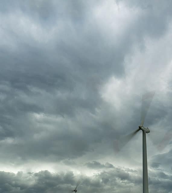
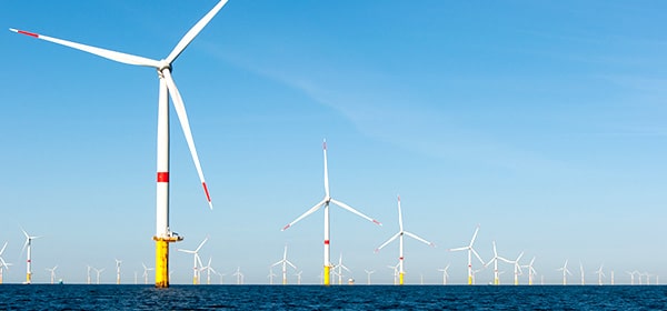
The Gulf of Lion, an area with a high potential for the development of floating wind turbines, is the focus of the challenges of fine characterisation of the wind resource and precise knowledge of the environmental conditions.

In this region, direct measurements are currently collected through a network of coastal anemometers. However, offshore data are needed to validate the numerical models used to characterise the resource and to design the systems.

While the installation of anemometers on masts in deep waters is technically excluded, the use of remote sensing devices, such as profiling lidar, is promising.

POWSEIDOM Project

Objectives

  • To overcome the lack of wind and turbulence data from in-situ measurements in the Gulf of Lion
  • To propose specific recommendations for the design of offshore wind turbines in this region

Main achivements

Deployment of a WindCube v2.1 lidar operating at 4 Hz (acquisition frequency 4x that of a commercial lidar of the same type)

Preliminary study of the lidar’s ability to measure turbulence by comparison with a mast equipped with anemometers

Characterisation of turbulence in the Gulf of Lion using measurements from a lidar deployed on the island of Planier

Testing a lidar onboard a mobile platform reproducing the movements of a buoy deployed at sea

Development of a motion compensation algorithm

Elaboration of recommendations for calculating wind-induced loads acting on structures deployed in the Gulf of Lion, taking into account turbulence intensity and spectra

Main outputs

  • Dataset for comparing lidar versus anemometer measurements
  • Processed dataset from lidar measurements taken over a period of one year at a site representative of pilot farms in the Mediterranean: mean winds and direction, turbulence intensity, dissipation, low level jets
  • Methodology for characterising atmospheric turbulence using the so-called variance method applied to data from lidar measurements
  • Dataset for comparing fixed versus mobile lidar measurements
  • Preliminary motion compensation algorithm for measuring turbulence using onboard lidar on a mobile platform

Conclusion

POWSEIDOM demonstrated the ability of a profiling lidar to measure turbulence intensity and laid the foundations for a motion compensation algorithm. Unprecedented data sets have been compiled in terms of location, frequency and duration acquisition. Recommendations based on turbulence intensity and spectra were drawn up for calculating wind-induced loads on wind turbines.

Partners

This project was led by France Energies Marines.

Logo France Energies Marines
Logo Centrale Méditerranée
Logo EDF
Logo Ifremer
Logo OW Ocean Winds
Logo Pôle Mer Bretagne Atlantique
Logo Pôle Mer Méditerranée
Logo Région SUD Provence-Alpes-Côte d'Azur
Logo Shell
Logo Vaisala 2025

Funding

This project received French State funding managed by the National Research Agency under the France 2030 investment plan (ANR-10-IEED-0006-34).

Logo France 2030

Labellisation

This project was certified by the maritime cluster Pôle Mer Méditerranée.

Logo Pôle Mer Méditerranée

Pour aller plus loin

Ajoutez votre titre ici

Lorem ipsum dolor sit amet, consectetur adipiscing ut elit tellus

Ajoutez votre titre ici

Lorem ipsum dolor sit amet, consectetur adipiscing ut elit tellus

Ajoutez votre titre ici

Lorem ipsum dolor sit amet, consectetur adipiscing ut elit tellus

Know more

Would you like to know more ?